Hi all! I just got back from a three-day hike through Dogon Country. The Dogon people are an ethnic group here in Mali. They are the ones who are still primarily animist (although some are Muslim or Christian). They live in the Mopti region (the region between Segou and Timbuktu). If I have my story right, the Dogon people fled from the Muslims into this area about 1000 years ago, and built mud houses high up in the rocky cliffs. People to this day still don't know how they got up to their homes (legend says that they flew, and some hypothesize that there used to be vines running down the cliffs that they could've climbed, but no one knows for sure).

(Some of the old cliff houses -- you can see the entrances on the different levels, although they blend into the cliff really well.)

(Some of the lower cliff dwellings off in the distance.)
After spending a night in Sevare, Yuri, Dom (Yuri's friend visiting from the US) and I met up with Hassimi, a national guide here in Mali. We decided to hike the "Three Yougas" (Youga is the name of three villages in the same area). Hassimi is the unofficial Peace Corps guide -- pretty much every volunteer uses him when they need a guide. And hiking through Dogon without a guide is not recommended (you would miss out on a lot of sacred places and objects -- or you'd trample right through them without knowing and offend/anger the people).

(Yuri, me, Hassimi and some guy Hassimi paid to carry his stuff.)
Hassimi is awesome. He's fluent in French, English, Bambara, and many dialects of Dogon. He drives you in his own car (which he's named "Grandma"), and he loves telling riddles. He's really funny and he made our trip completely awesome. It's no wonder he's got such a good rappor with Peace Corps.
We drove from Sevare to the Dogon village Sanga, where we began our hike. I already couldn't believe the change in scenery. There were rocks EVERYWHERE! In Segou, there is only dirt and sand. To build soak pits in his village (in the Segou region), my friend Kyle had to buy and import rocks from the city. But in Dogon, there were entire buildings made of rocks. It was really beautiful.

(Building and stone wall in Sanga.)

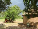
(A Dogon village.)
We began our hike from Sanga down to the valley. I hadn't realized that we were on top of a cliff until we began hiking down it! The view was amazing. There was a tall waterfall way off in the distance, and huge plateaus everywhere.

(View on the way down the first cliff.)
We hiked down the cliff and walked a few kilometers down a sandy road to a village, where we stayed the night. The second day, we got up early and began the long trek. We walked for a long time down that same sandy road, until we reached a village on the base of another cliff.

(A Dogon meeting room -- it's constructed that low so men can't get angry and stand up, and also so they always stay in the shade.)
 (The beginning of the climb.)
Then we began climbing. It was really steep -- many times I was using my hands just as much as my feet to climb. It also was getting to be midday, so the sun was really strong. We ate lunch next to some old mud cliff dwellings.

(The view of the mud cliff dwellings from where we ate lunch.)

(A village up in the cliff.)
 (This is rainwater collected on the cliffs. The women collect this water and carry it down to the village to use for drinking, cleaning, etc. Otherwise they have to hike all the way to the bottom of the cliffs to get water from the lakes that are created during rainy season.)
The children in the villages would come running barefoot down the rocks to hold our hands while we walked. They would ask over and over again, "ca va?" But then they'd always follow up with, "ca va, un bonbon?" or ca va, un cadeau?" (meaning: give me candy or a present). Despite that, they were really friendly -- moreso than the kids I usually run into in Segou.

(Dom surrounded by kids while resting)

(A boy with his brother on his back...they followed us for a bit.)
We had to climb up steep steps and crazy wooden ladders. Getting up the cliff was half the fun...
 (Steep stone steps.)

(Yuri climbing up a rock ladder.)
When we finally reached the top of the cliff, the view was breathtaking. Hassimi estimated that you could see about 20k out. It was one of the best views I've ever seen.

(The top of the cliff.)

(Yuri, me and Dom)

(The view again.)
We hiked back down the other side, walking over stick-and-rock bridges and scrambling down boulders.
(A bridge made of tree limbs and rocks -- the cliffs below

(Self portrait.)
We had almost reached the village we were to sleep at when we saw dark clouds off in the distance. We quickened our pace, but we weren't quick enough. Within five minutes of spotting the clouds, the rain had reached us. We suddenly were in the middle of a downpour. I had to take off my sandals and climb down the rocks barefoot just to get some traction. The rain didn't last long, though, and twenty minutes later we reached our destination.

(The storm approaching -- the last picture I got to take before getting drenched.)
The final day, we hiked across the cliff toward Sanga.

(On the way back.)
Before reaching Sanga, we came up on a reservoir. The water flowed off the cliff we were on. We realized we had reached that same waterfall that we'd seen the first day -- the one that had been so far away. It was then that I realized just how far of a loop we'd made.

(View from the top of the waterfall down to a village below.)
I was pretty sore by the end of the trip, but it felt so good to do something active outside again. And the scenery was the best I've seen out of anywhere I've been in Africa!

 (Some of the lower cliff dwellings off in the distance.)


 (The beginning of the climb.)


 (This is rainwater collected on the cliffs. The women collect this water and carry it down to the village to use for drinking, cleaning, etc. Otherwise they have to hike all the way to the bottom of the cliffs to get water from the lakes that are created during rainy season.)


 (Steep stone steps.)


 (View from the top of the waterfall down to a village below.)


